Sunday, January 16, 2011

Leaving the Ice

Well it is time to leave the Ice. The night before our flight we all gather at the Air Transport Operations (ATO) building for "bag drag". We bring all of our luggage and wear - or at least have with us - the required extreme cold weather gear needed for the flight which includes windpants, 'big red', bunny boots and goggles/sunglasses.

 We have ourselves and luggage weighed, show our passports and are cleared for the next morning's flight.

We report to the ATO at 2:15 am for our flight home on a C-17.

We all board Ivan the Terra-bus for the hour long ride to the Pegasus Airfield.

A view of Observation Hill from the road to Pegasus Airfield. 

 Once we get to Pegaus Airfield, we wait inside the Passenger Terminal.

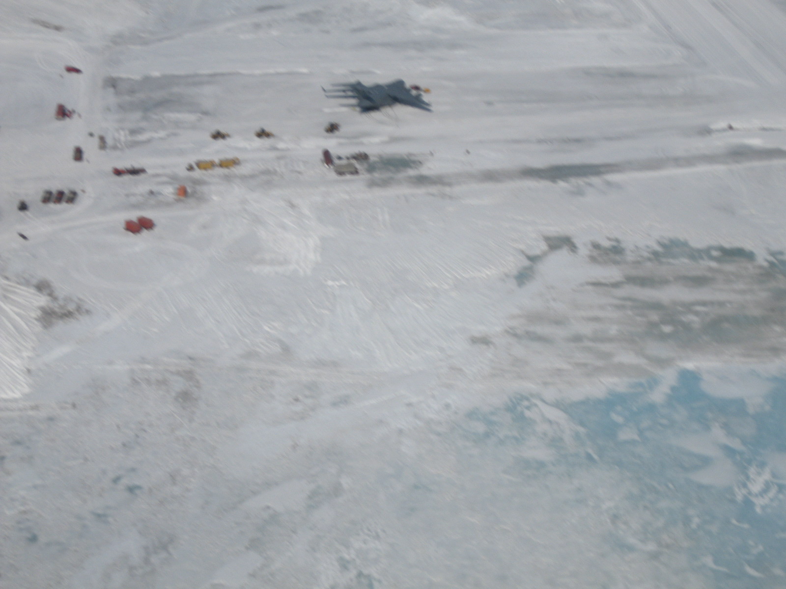
Here are the heavy machines that are needed to offload and onload palleted cargo for the C-17.

The weather is right and the runway is good. The C-17 comes in for a perfect landing at 4 am. 

Ivan the Terra-bus is in position for the departing C-17 passengers. Others wait to board the C-17.

 Passengers depart the C-17 and equipment moves in to offload the cargo.

Close up of the C-17 cargo operation. The engines never shut off during offload and onload of passengers and cargo. Great care is exercised during these operations for the safety of all involved.

We can finally head toward our flight out!

It really is an amazing aircraft!

Inside the cargo area. Some decide to lie on the floor and sleep during the 5 hour ride to Christchurch, New Zealand - our long awaited destination.

We make it to Christchurch by 10:30am local time.

A wet day, but a well received welcome. We all notice the trees and humidity and warmth!
My time on the ice is at an end for this time around.
Only time will tell to see if I return again to the great adventure that is Antarctica.


Scott Base Visit

One day I visited the New Zealand Station of Scott Base. It is located a few miles from McMurdo Station on the other side of Observation Hill. I wanted to talk to the IT person there to find out how communications worked for Scott Base.

Anthony (on the left) gave me a tour of the base and then I was invited to attend dinner a few weeks later. Scott Base is much smaller in size than McMurdo Station. Scott Base houses about 60 participants while McMurdo houses up to 1100 participants. This means that the Scott Base participants have more than one job while living there. This is a photo of the inside of the bar area.

Scott Base buildings are all light green in color.

This side faces the ice pressure ridges.


The inside is made up of many corridors which connect a number of the buildings.
There are many New Zealand experiments and scientific studies that continue year round.
It was a great honor to be able to take a tour of the facility and learn how they live and work. An even greater honor to be invited to dinner - which was very yummy!

Visit to Black Island

I was fortunate enough to be able to take a helicopter trip to Black Island to visit the facility and located there. It is considered a field camp and anyone who visits the location has to have completed the Snow School Course (Happy Camper School) and other USAP Environmental training.
Here is the helicopter tech wheeling out our luggage.


The first flight was early in the morning. The weather was cloudy, but there was a line of sight that the heliport could see to the Black Island facility. The green building on the left is the helicopter workshop and the small white building is the helicopter passenger terminal.

Inside the passenger terminal is where each passenger is weighed with their luggage and helmet.

As we were 700ft in the air and flying out to Black Island, we could not see Black Island and so we had to turn around.

Later that same day we were able to fly again. This time we were able to see Black Island from an altitude of 900 ft and so we were able to complete the 15 minute flight to the Black Island helicopter landing pad.

This is a photo of the Pegasus airfield. It is the shelf ice runway used after the sea ice runway is no longer able to support the weight of the large aircraft. The C-17 is shown in the middle of the top end of the photo.

 This is Black Island. The facility is just above and to the right of the snow on the bottom left of the photo.

 This is a photo of neighboring White Island.

This is the helicopter on the landing pad at Black Island.

 
This is what the shelf ice looked like. The white is snow and the blue is the ice. 

This is a view of McMurdo station as we flew back from Black Island.

This is a photo of the helicopter we rode back in three hours later. It is the New Zealand helicopter and pilot.
It was a great day!

Saturday, December 25, 2010

HIking Hut Trail

Diving Hut

The ice is really melting and the diving huts were all taken off of the ice a few weeks ago before the ice got too thin for heavy vehicles to travel on. You can see the tow bar on the right of me. It attaches to a vehicle which then tows it off of the ice and to the storage area which is on the way to Hut Point.


Ice Pier
The ice pier has lots of water around it now, mostly from the two run offs coming off the hills.


 Water Run Off
The snow on the hills are really melting and lots of water is flowing down toward the pier

 Santa on the Whale Sculpture
Holiday decoration on the way to Hut Point.

 Hut Point - Vince's Cross
This location is at the end of Hut Point.

 Seal Resting on Ice
There is now room for seals to come up out of the water to rest. This is not too far from where the underwater observation tube was located.

 Skua at Rest
While hiking we saw three skuas flying and one landed here. We think it may be the nest.

 Water and Ice Along Hut Point
Here you can see how the ice has melted and the bright blue water is getting wider.

This is a view of Hut Point from above. We are still on the trail.
It was a beautiful day for a hike. More pictures later.

If you have any questions you can email me at marybeckman@earthlink.net

Saturday, December 11, 2010

Weather Satellite Antenna Installation at T-Site


One of the projects I am involved with here at McMurdo is to support the group who is installing a new weather satellite antenna in McMurdo. There is a lot of preparation and many persons are involved in getting the site ready. This photo is of the temporary power that is needed at the site.


 This is a photo of the concrete slabs that make the foundation for the outside dome around the antenna which is called the radome.

A phyiscal survey is needed to determine the latitude and longitude of the site location.


The radome is made up of many triangular panels. You can see one of the panels here. They are all put together with metal brackets and bolts.


The bottom ring of the radome is shown here.


A crane is needed to build the top two thirds of the radome. The ropes at the bottom of the structure here are used to keep it tied down for when the wind kicks up.


The crane is lifting the kingpost, which the antenna reflector dish is attached to, to be placed in the center of the foundation.


The top of the radome is placed on the first ring after the reflector dish is secured to the kingpost.


This is what it looks like on the inside of the radome.

This is the first installation of this type of weather antenna satellite which is to be installed at many locations around the world.